Jelsa
About this place
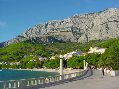
Jelsa lies on Hvar’s northern coast, where island life is easiest to understand between the waterfront, stone squares and vineyard-covered hinterland. The settlement developed as the harbour of Pitve, while seafaring and wine strongly shaped its growth during the 19th century. St John’s Square, with its small octagonal church, forms an intimate centre, while the fortified parish Church of the Assumption recalls the insecurity of the 16th century. Above Jelsa, Tor preserves the remains of an Illyrian tower from the 4th–3rd century BC, and Galešnik adds a medieval defensive layer. Mina, about a kilometre from the waterfront, is a convenient swimming spot with shallow water and pine shade. Jelsa is more than a beach base: short routes lead towards Pitve, vineyard landscapes and Hvar’s interior, while coastal paths connect nearby coves. The compact centre is easily explored on foot, with a car or bicycle becoming more useful for villages and viewpoints farther inland.
Jelsa is a compact town on Hvar’s north coast, arranged around a sheltered harbour, a renewed waterfront and a park shaded by mature trees. It developed as the port of the inland village of Pitve, and its fabric still divides into Vela Banda and Mala Banda, whose stone lanes descend towards the water. The municipality encompasses twelve settlements and remains closely tied to the vineyards, olive groves and villages of central Hvar. By road, Jelsa is 9 kilometres from Stari Grad ferry port, 28 kilometres from Hvar Town and 51 kilometres from Sućuraj. Its unusually generous choice of walkable beaches gives Jelsa a different rhythm from island bases where every swim requires a car.
Stays nearby
 Apartment
Apartmeni Klenovica.eu
Klenovica
Klenovica, 262 km from Jelsa
up to 4 guests · 1 bedroom
The host confirms the exact price for your dates and availability.
Things to see
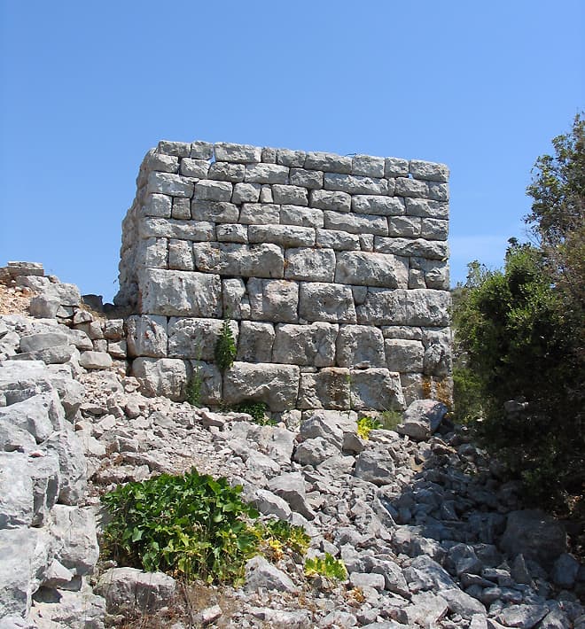
St John’s Square is framed by stone houses and the octagonal Church of St John, with the present space taking shape between the 17th and 19th centuries. Nearby stands the parish Church of the Assumption, whose fortified appearance reflects defensive rebuilding in the 16th century. Older layers lie above the settlement: Tor is the remnant of an Illyrian tower from the 4th–3rd century BC, while Galešnik belongs to the medieval period. At Gradina, traces survive of an Augustinian monastery founded in 1605. Together these sites give Jelsa a historical range stretching from prehistoric defensive positions to a Renaissance and Baroque island settlement.
Beaches
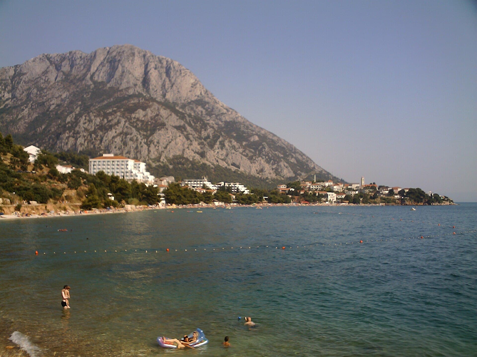
Mina is the nearest named beach south of Jelsa’s waterfront, occupying a sandy cove with a restaurant and terraces immediately above the sea. Farther east, a string of swimming spots continues towards Čorni Petar, reachable on foot or by bicycle along the coastal road; drivers approach from the main road and park among terraced olive trees. Across the bay, the Gradina shoreline combines swimming with remnants of ancient Ielsa’s defensive wall. For a broader beach day outside town, Soline near Vrboska offers extensive parking together with a restaurant and café.
Bathing water quality nearby
- Hotel Fontana · 1.1 kmexcellent · season 2025
- Uvala Mina · 1.1 kmexcellent · season 2025
- Kupalište Soline · 2.5 kmexcellent · season 2025
Source: European Environment Agency (EEA); data from Croatian authorities. · bathing water profile
Food and drink
Choosing where to eat in Jelsa can follow the town’s geography: Bistro Obala sits directly on the waterfront, Pelago is about 40 metres from the promenade, and Mina Restaurant & Lounge Bar overlooks Mina’s sandy cove. Nono occupies a quieter part of town, while centrally placed Kalina draws on the Božiković family’s farming background. Alongside fish and seafood, look for Hvar olive oil, island cheeses and wines from vineyards around Pitve and other villages in Jelsa municipality. Wine and oil tasting can also be combined with a meal at the Murvica family farm and restaurant.
Practical information
Practical information
The Jelsa Tourist Board office is at Trg Tome Gamulina 1 and can be contacted on +385 21 761 017 or [email protected]. The harbour is the town’s main reference point: the park, main square, St John’s Square and coastal path to Mina are all within walking distance. Jelsa lies 9 kilometres from Stari Grad port, so travellers bringing a car usually enter Hvar there and continue along the D116 road. The tourist board maintains a dedicated service-information page for emergency and local contacts, while sailing updates should be checked with the operator before travelling to Jelsa’s harbour.
Getting there and around
In 2026 Jelsa is linked with Split by a passenger catamaran calling at Bol on Brač; Jadrolinija gives a sailing time of about 65 minutes from Split to Bol and another 90 minutes onward to Jelsa. The catamaran does not carry cars, so motorists normally use the Split–Stari Grad ferry and drive the remaining 9 kilometres along the D116. The alternative road approach uses the Drvenik–Sućuraj ferry, although Sućuraj is 51 kilometres from Jelsa. A ticket for the Jelsa catamaran secures the selected departure, and its timetable changes between operating seasons.
Frequently asked questions
How far is Mina from Jelsa’s waterfront?
Mina is about one kilometre from the central waterfront, making it practical to reach on foot.
What is Tor above Jelsa?
Tor is a site with the remains of an Illyrian tower dated to the 4th–3rd century BC.
Why does Jelsa’s parish church look fortified?
The Church of the Assumption was defensively rebuilt in the 16th century, which explains its strongly fortified appearance.
What is found on St John’s Square?
The square contains the small octagonal Church of St John, surrounded by the stone houses of the historic centre.
Nearby
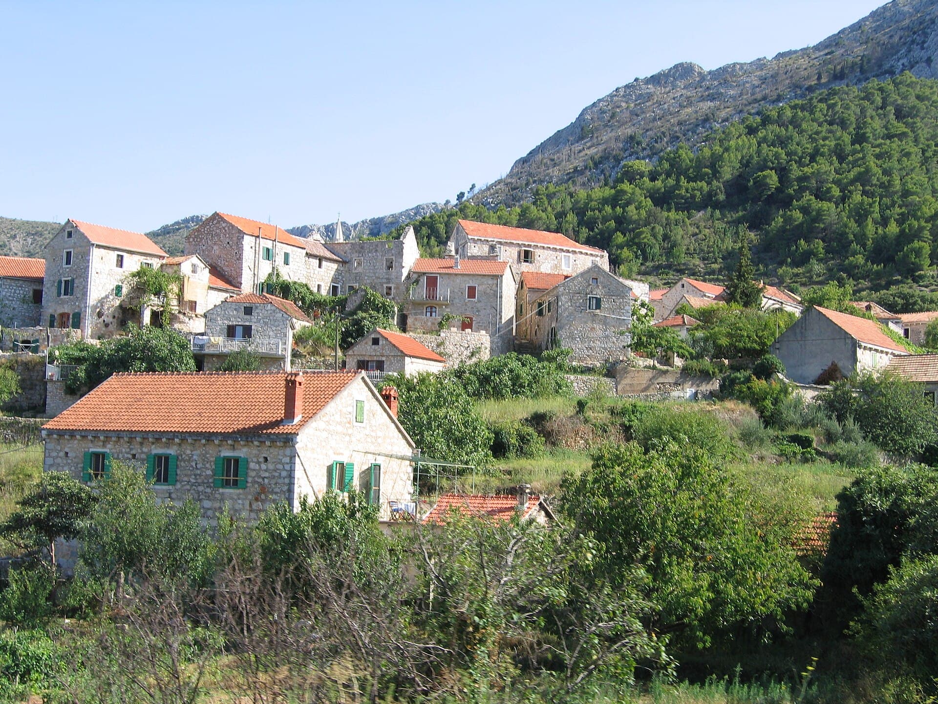
Pitve
Village · Hvar

Related guides

Split
In Split, the transition from ancient monument to ordinary street is almost imperceptible: entering the southern part of Diocletian’s Palace from the Riva leads towards the Peristyle, then…
Read the guide

Help improve this page
Spot something missing or wrong? Suggest a correction, add your photo or report a problem. Editors review every suggestion before it is published.
Photo credits
- Jelsa, Pitve, Ivan Dolac — Juloml · CC BY-SA 3.0 · Wikimedia Commons
- Zavala, Jelsa — Topalaska · CC BY-SA 4.0 · Wikimedia Commons
- Vrboska — Carsten Steger · CC BY-SA 4.0 · Wikimedia Commons