
Vis
About this place
Vis island is best explored by distinguishing its settlements, coastline and smaller neighbouring islands. Vis town and Komiža are different bases, and accommodation choice affects daily travel and excursions. Komiža's Fishing Museum introduces working life at sea, while the bays demonstrate that beach surfaces vary: Srebrna is associated with pebbles, whereas Stončica, Milna and Zaglav have sandy areas according to the regional tourist board. The Green Cave belongs to Ravnik islet, requiring a sea excursion rather than a short walk from a town centre. Vis suits travellers willing to adapt plans to geography and weather instead of relying on a guaranteed sequence of swims and boat tours. Spend the first day around your base and one accessible shore; with longer stays, separate cultural visits, an outing to the other settlement and a possible sea trip. Former military spaces are not an invitation to enter tunnels independently without confirmed access. Allow time for local harbours and the landscape rather than organising every day around the search for just one celebrated cove.
Two large bays gather Vis's main settlements: Vis town occupies the island's northeastern shore, while Komiža faces west beneath Hum. Between them lie karst fields and small communities including Podšpilje, Podhumlje and Plisko Polje, connected with vineyards and cultivated land. The white grape Vugava, locally called Bugava, is one of this agricultural landscape's distinctive names. In the southeast, Rukavac faces offshore islets and Ravnik with its Green Cave; off Komiža lies the separate island of Biševo. The Put poja themed geotrail in Komiža's hinterland introduces the people of the fields, their stone huts, lime kilns and dry-stone walls, adding an inland dimension to Vis's better-known fishing heritage.
Top places
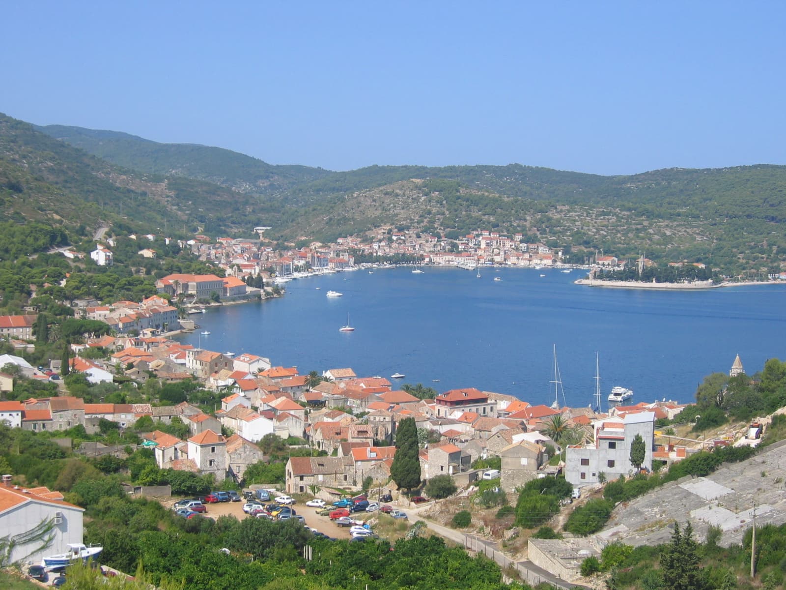
Vis
Town · Vis

Stays nearby
 Apartment
Apartmeni Klenovica.eu
Klenovica
Klenovica, 252 km from Vis
up to 4 guests · 1 bedroom
The host confirms the exact price for your dates and availability.
Things to see
In Vis town, Gospina batarija houses the Split Archaeological Museum's Issa collection, with underwater archaeological finds and objects from prehistoric and Hellenistic periods. The fortress itself belongs to the island's Austrian military heritage, placing ancient material inside a much later building. Komiža's Komuna fortress presents a fishing collection, including fishing and processing equipment and the traditional gajeta falkuša. The Ivan Vitić Cultural Centre in Komiža contains the Vis Archipelago Geopark visitor centre, with a geological collection and interpretation of the island area. The Issa collection also includes finds from Biševo, Svetac and Palagruža, extending its archaeological perspective beyond the former Greek town on Vis.
Beaches
Srebrna near Rukavac has larger pebbles, rock slabs and coastal pines, while Stončica has a sandy section inside a deep bay. Stončica also shares its name with the nearby lighthouse headland; Srebrna belongs to Vis's southeastern coastline. Stiniva is distinguished by high limestone cliffs narrowing the mouth of its cove, a shape that forms part of the island's geological story. Ravnik and its Green Cave are separated by sea from the beaches around Rukavac. A day at Srebrna can remain a land-based swimming outing, whereas visiting the Green Cave requires a separate boat journey to Ravnik.

Things to do
For a one-day stay, choose Vis town or Komiža as the main focus according to your arrival point and available transport. In Komiža, connect the harbour with the Fishing Museum and then one accessible coastal area. Avoid promising yourself several distant coves and a sea cave in the same short day. With three days, keep the first around your base, the second for the other settlement and culture, and the third for a weather-appropriate boat outing or selected beach. The Green Cave on Ravnik and sites around other islets require separate transport and condition checks. A cancelled sailing is not a reason to attempt a risky independent coastal approach. Choose beaches by surface, access and current conditions rather than aerial photographs. Stiniva is one specific cove, not a name for the whole Vis coastline, and its access needs separate assessment. Include former military structures only through confirmed permitted and appropriately organised visits. Establish a realistic return before every distant outing, especially when a mainland sailing is booked for the same day.
Activities
The Put poja geotrail explores Vis's interior through dry-stone walls, lime kilns, stone huts and fields behind Komiža. Walking this route has a cultural dimension: field boundaries and working buildings reveal how land was cultivated and lime produced on Vis. The geopark also offers separate Komiža and Vis–Rukavac geotrails covering different parts of the island. For organised running, Komiža Trail on 24 October 2026 has 7-, 16- and 22-kilometre categories, starting and finishing on the waterfront. Even the shortest category includes 350 metres of ascent, making those seven kilometres in Komiža's hinterland substantially different from a level seaside stroll.
Day trips
The Blue Cave lies in Balun bay on Biševo, so an excursion from Komiža involves crossing to another island. Its blue light comes through an underwater opening, while visitors enter in a small boat through a low passage. A clear sky over Vis does not guarantee a calm entrance at Biševo: swell can prevent access to the Blue Cave. The Green Cave belongs to Ravnik off southeastern Vis and is not another name for the Biševo site. A geology-focused outing can begin at Komiža's geopark visitor centre, which introduces the differences between Vis, Biševo and the archipelago's more distant islands.
Food and drink
Viška and komiška pogača share a filling of salted fish and onions, but the Komiža version also contains tomato. Traditional recipes cut the Vis version into triangles and the Komiža one into squares, although the filling matters more than the shape. Vugava, often called Bugava locally, is a white grape associated with Vis's vineyards; Plavac Mali produces red wines. Gušti poja, a tavern in the island's interior, belongs to the GEOfood network linking food with geopark territories. Its published profile highlights local producers' wines and carob or orange cakes, providing a specific food stop to accompany an exploration of Vis's cultivated fields.
Towns
All other placesShow all 4Hide list
Practical information
Practical information
Scheduled boats arrive in Vis town, with the onward journey to Komiža made by road. A separate Komiža–Vis–Komiža bus timetable is published for 28 September to 6 December 2026, providing the relevant island connection for autumn arrivals. The municipal website identifies Nautical Centre Komiža as the bus operator and separately publishes route 612 towards Biševo. The geopark's main visitor centre is in Komiža's Ivan Vitić Cultural Centre, while the Issa collection is in Gospina batarija in Vis town. Those two buildings provide clear destinations when dividing a cultural day between the island's opposite sides.
Parking
Rogači is the public car park for visitors arriving in Komiža, operated by Nautical Centre Komiža. In the guidance available in September 2026, its day ticket differs from the weekly ticket: leaving ends the day ticket's access, whereas the weekly option allows repeated entry and exit. For Srebrna near Rukavac, the Vis Tourist Board identifies parking approximately 250 metres from the beach. Reaching Srebrna therefore ends with a walk to the pebble shore; parking at Rogači belongs to a separate arrival in Komiža on the western side of Vis.
Getting there and around
Jadrolinija's vehicle ferry route 602 connects Split with Vis town; the operator's 2026 information gives a crossing of approximately two hours and twenty minutes. Buying a ticket reserves the chosen departure, unlike the system used on some shorter island crossings. The Komiža–Vis bus provides the onward journey across the island, with timetables published by Komiža municipality and the Vis Tourist Board. State boat route 612 links Komiža with Biševo separately from the Split ferry. A Blue Cave excursion on Biševo also involves entry into the cave by small boat, which is a different service from reaching Biševo on its regular boat connection.
Frequently asked questions
Are Vis and Komiža the same place?
No. They are separate settlements and holiday bases.
Is the Green Cave in Vis town centre?
No. It is on Ravnik islet and requires access by sea.
Are all Vis beaches sandy?
No. Surfaces vary; Srebrna is pebbly and some other bays have sand.
May I enter former military tunnels independently?
Not without checking permission, safety and suitable visitor arrangements.
Are boat excursions guaranteed daily?
Related guides
Vis
Vis occupies the north-eastern end of the island, inside the sheltered Bay of St George. Its two distinct faces are Luka, the busier harbour quarter beside the ferry terminal, and…
Read the guide
Help improve this page
Spot something missing or wrong? Suggest a correction, add your photo or report a problem. Editors review every suggestion before it is published.
Photo credits
- Vis — Carsten Steger · CC BY-SA 4.0 · Wikimedia Commons
- Vis — Minestrone · CC BY-SA 4.0 · Wikimedia Commons
- Komiža — ModriDirkac · CC BY-SA 4.0 · Wikimedia Commons
- Tito’s Cave, Host Lighthouse — Ex13 · CC BY-SA 3.0 · Wikimedia Commons


