
Saborsko
About this place
Saborsko is a highland settlement on a plateau between the Mala Kapela range and the Plitvice Lakes area, in the south-eastern part of Karlovac County. It lies about 22 kilometres from the national park’s main entrance, yet its defining experience is not the busy lakeside circuit but a landscape of forests, meadows and the springs of the sinking Jesenica River. A seven-kilometre trail leads from the village centre to five springs that form the river, requiring roughly three hours in one direction. A shorter five-kilometre loop crosses Alan hill and the Way of the Cross before passing the medieval Church of the Nativity of the Blessed Virgin Mary and the Church of St John of Nepomuk. Saborsko also carries a powerful memory of the Croatian War of Independence, expressed through local memorials and its restored sacred landscape. Wooden shingles are more than decoration here: a local workshop preserves a craft protected as intangible heritage. The D42 road links Saborsko with Plaški, Josipdol and the Plitvice approach, although its bends and narrow sections reward unhurried driving. With limited public transport, the area is most practical by car, bicycle or pre-arranged transfer.
Saborsko occupies a mountain plateau beside the D42 road, surrounded by the forests of Mala Kapela and meadows above the Jesenica valley. Its municipality also includes Lička Jesenica, Blata and Kuselj, and has been promoted within the Plitvice Valleys destination organisation since that body was founded in 2022. The village’s identity combines a karst river landscape, wooden-shingle craftsmanship and church heritage with the painful legacy of the 1991 destruction. Proximity to Plitvice Lakes drives many visits, but the paths towards the Jesenica springs give Saborsko a distinct reason to stop.
Stays
No stays listed here yet
Things to do
For a shorter visit, take the five-kilometre loop from central Saborsko to the viewpoint on Alan hill, then descend the Way of the Cross to the medieval Church of the Nativity of the Blessed Virgin Mary. The route also passes St John of Nepomuk Church and the defenders’ memorial and takes about two hours. A longer day can follow the trail to the five Jesenica springs: it runs seven kilometres from the centre across meadows into a wooded hollow, taking around three hours each way. Arrange a return transfer in advance or reserve enough energy to retrace the route.
Practical information
Getting there and around
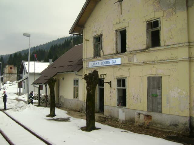
Saborsko stands on the D42 state road, linking the Plaški direction with the approach to Plitvice Lakes. The municipality’s visitor map gives distances of 46 kilometres to Ogulin, 94 kilometres to Karlovac and roughly 22 kilometres to the main Plitvice entrance. The route from Ogulin runs through Josipdol and Plaški, with winding mountain sections. The M604 railway crosses the municipality and has stations at Blata and Lička Jesenica, but it does not serve Saborsko village itself. A private car is therefore the most practical way to connect the walking trails, churches and Plitvice Lakes.
Frequently asked questions
How far is Saborsko from Plitvice Lakes?
The municipality’s visitor map places Saborsko about 22 kilometres from the national park’s main entrance.
How long is the walk to the five Jesenica springs?
The route is seven kilometres each way, with an indicated walking time of about three hours.
Does Saborsko have a railway station?
There is no station in Saborsko itself; within the municipality, the M604 railway serves Blata and Lička Jesenica.
Nearby
Lička Jesenica
Village · Lika – Karlovac

Related guides

Senj
Senj occupies a narrow strip between the sea and the Velebit foothills, so its streets climb quickly from the harbour towards Nehaj Fortress. The Uskoks, the fierce bura wind, seafaring and…
Read the guide
Help improve this page
Spot something missing or wrong? Suggest a correction, add your photo or report a problem. Editors review every suggestion before it is published.
Photo credits
- Saborsko, Rakovica — Modzzak · CC BY-SA 3.0 · Wikimedia Commons
- Lička Jesenica — Kiki273 · CC BY-SA 3.0 · Wikimedia Commons
- Jezerane — Fraxinus Croat · CC BY-SA 3.0 · Wikimedia Commons
- Senj — Palauenc05 · CC BY-SA 4.0 · Wikimedia Commons

