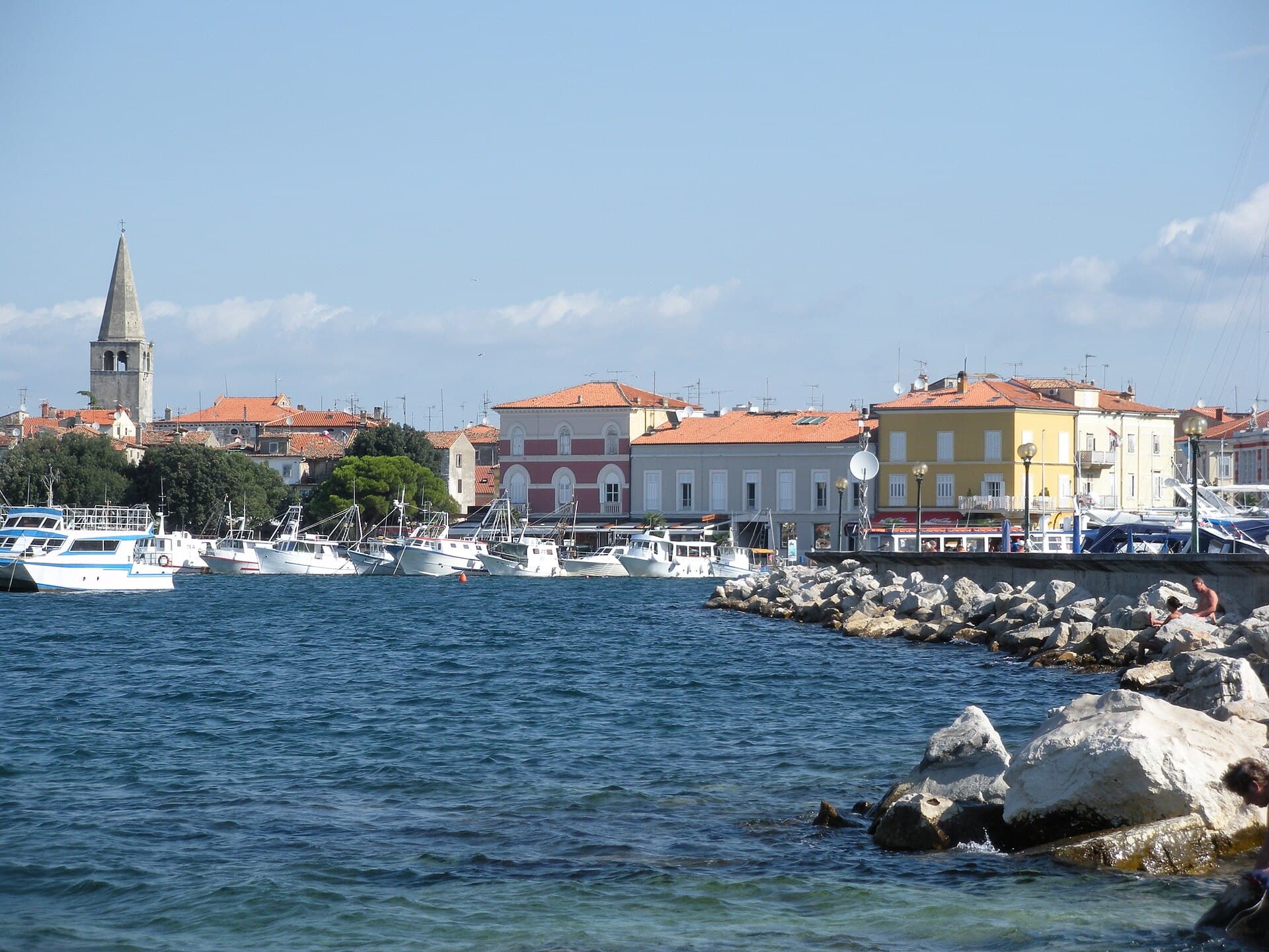
Vrsar
About this place
Vrsar rises on a hill above Istria’s western coast, so a visit naturally moves between the harbour and the steep lanes of the old town. Its medieval street pattern follows the terrain, while several viewpoints overlook the islet of Sveti Juraj, the marina, Montraker and the Funtana archipelago. Montraker public beach lies about half a kilometre from the historic centre and combines pebbles, rocks and paved platforms, allowing sightseeing and swimming to be joined without a car. South of town begins the landscape of Lim Bay, a submerged karst valley about 12.8 kilometres long and very different from the urban waterfront. Vrsar is also associated with stories of Giacomo Casanova, although the town’s topography, viewpoints and coast shape the visit more strongly than any single historic personality. For a balanced day, walk from the harbour into the old town, descend to Montraker, and leave Lim Bay for a separate outing.
Vrsar’s old town developed on a prominent hill above the sea and retains a medieval pattern of narrow, winding and frequently steep streets. Walking from the waterfront to the top is therefore more than movement between sights: stairways, stone houses and passages follow the natural slope and explain the town’s form. Views open towards the islet of Sveti Juraj, the marina and the abandoned Montraker quarry. Vrsar is small enough for the harbour, historic centre and nearby beach to be linked on foot, although the steep gradients mean the same route is not equally easy with pushchairs or for visitors with limited mobility.
Stays
No stays listed here yet
Things to see
Vrsar’s viewpoints are distributed around the old town and face different parts of the coast. St Anthony viewpoint lies below the Church of St Anthony of Padua, St Martin is behind the parish church, while Bepo and Tonina is marked by a stylised sculpture of a man and woman. The Casanova viewpoint includes a stone bench designed as an artwork. Rather than searching for one dominant panorama, visiting these points traces the edge of the hill and reveals how the old town relates to the harbour, Sveti Juraj, Montraker and the coast towards Funtana. The sequence works best as part of a walk through the historic centre.
Beaches
Montraker public beach lies about 500 metres from Vrsar’s old town and combines pebble, rocky and paved sections. Facilities include a children’s area, natural shade, a sports centre, showers and places to eat, making it suitable for a longer stay after sightseeing. The wider Vrsar coast also includes Belvedere, Petalon, Porto Sole, Valkanela and Koversada, with varying combinations of fine pebbles, rocks and developed stone platforms. Montraker is particularly practical when you want to remain on foot near the historic centre, while the other beaches make more sense depending on where your accommodation is located.
Petalon
Beach · Vrsar
Petalon Beach by the Vrsar resort combines rocky shore, pebble sections and paved sunbathing terraces.
Things to do
Begin on Vrsar’s waterfront, climb through the old town’s narrow lanes, then descend towards the town beach and the former Montraker quarry. For a view from the water, excursion boats leave the harbour for panoramic trips through the Lim Channel and onward to Rovinj. A cycling or driving loop can continue into Kontija Forest and Kloštar, home to Istarska hiža Kontija. During summer 2026, the steep ascent is easier with the free shuttle linking the tourist office, Rotonda, Brostolade and the bus station. This sequence neatly connects Vrsar’s harbour, hilltop core and wooded hinterland without retracing the same route.
Food and drink
For dinner beside the harbour, look along Obala maršala Tita, where the official directory lists Al Mare, Azzuro, La Rosa and Miramare. Konoba Pjaca sits on Trg Degrassi in the old town, while Istarska hiža Kontija in Kloštar fits naturally after a woodland outing. A Vrsar meal is best anchored by fish or shellfish associated with the nearby Lim Channel, followed by Istrian cured ham, sausages or local wine. Casanova Beach Bar and Orlandin are both at the town beach, making them convenient for an informal post-swim meal rather than an evening climb into the hilltop centre.
Practical information
Practical information
The Vrsar Tourist Board office is at Obala maršala Tita 23; its telephone number is +385 52 441 746 and its email address is [email protected]. Because the office is close to the waterfront, it is a useful first stop for checking boat excursions, local events and seasonal transport before climbing into the old town. Travellers without a car should note the bus station at Saline, roughly 500 metres from the centre. Vrsar is strongly seasonal: beach, campsite and harbour services are broadest in summer, while restaurants and excursions outside the peak period are best confirmed directly before setting out.
Parking
Vrsar’s principal public parking areas include the large Saline car park, parking beside the bus station, the Montraker zone and spaces on Obala maršala Tita between the marina entrance and reception at number 1A. For the old town, Saline is the most practical choice because the free summer 2026 shuttle departs from this area for the Town Gate and Rotonda. This avoids searching for a space among the steep, confined streets of the historic centre. Municipal traffic rules also identify parking at Montraker and beside the school, making that side of town useful for visitors heading to the town beach.
Getting there and around
Local buses link Vrsar with Poreč, Rovinj and Pula, while the tourist board identifies Poreč, ten kilometres north, as the nearest larger bus terminal. Vrsar’s own stop is at Saline, about 500 metres from the centre, and includes parking. From 1 June to 13 September 2026, a free shuttle runs every 30 minutes between the bus stop beside the large car park and the old town, serving Brostolade, the kindergarten, Town Gate, Rotonda and the tourist office. For air arrivals, Pula is the practical gateway, followed by a road or bus connection through Pula and Rovinj.
Frequently asked questions
Is Vrsar old town flat?
No. The historic centre occupies a hill and many lanes are steep or stepped.
How far is Montraker from the old town?
Montraker public beach is about 500 metres from the historic centre.
What can you see from Vrsar viewpoints?
Views include the harbour, Sveti Juraj, Montraker, the coast towards Funtana and nearby islets.
How long is Lim Bay?
The official description gives a length of about 12.8 kilometres.
Does Montraker have natural shade?

Related guides

Novigrad
Novigrad-Cittanova developed on Istria’s north-western coast near the mouth of the Mirna, in a maritime setting that shaped centuries of fishing and trade. The historic centre still…
Read the guide
Help improve this page
Spot something missing or wrong? Suggest a correction, add your photo or report a problem. Editors review every suggestion before it is published.
Photo credits
- Vrsar — Ekaterina Polischuk · CC BY-SA 4.0 · Wikimedia Commons
- Funtana — Tanya Dedyukhina · CC BY 3.0 · Wikimedia Commons
- Rovinj — Florian Hirzinger - http://www.fh-ap.com · CC BY-SA 4.0 · Wikimedia Commons
- Novigrad — Sl-Ziga · Public domain · Wikimedia Commons
- Pula — Orlovic · CC BY-SA 3.0 · Wikimedia Commons