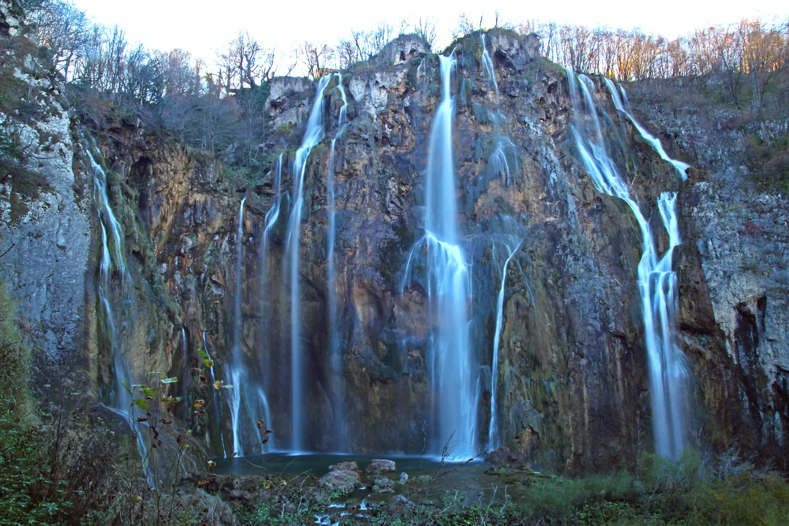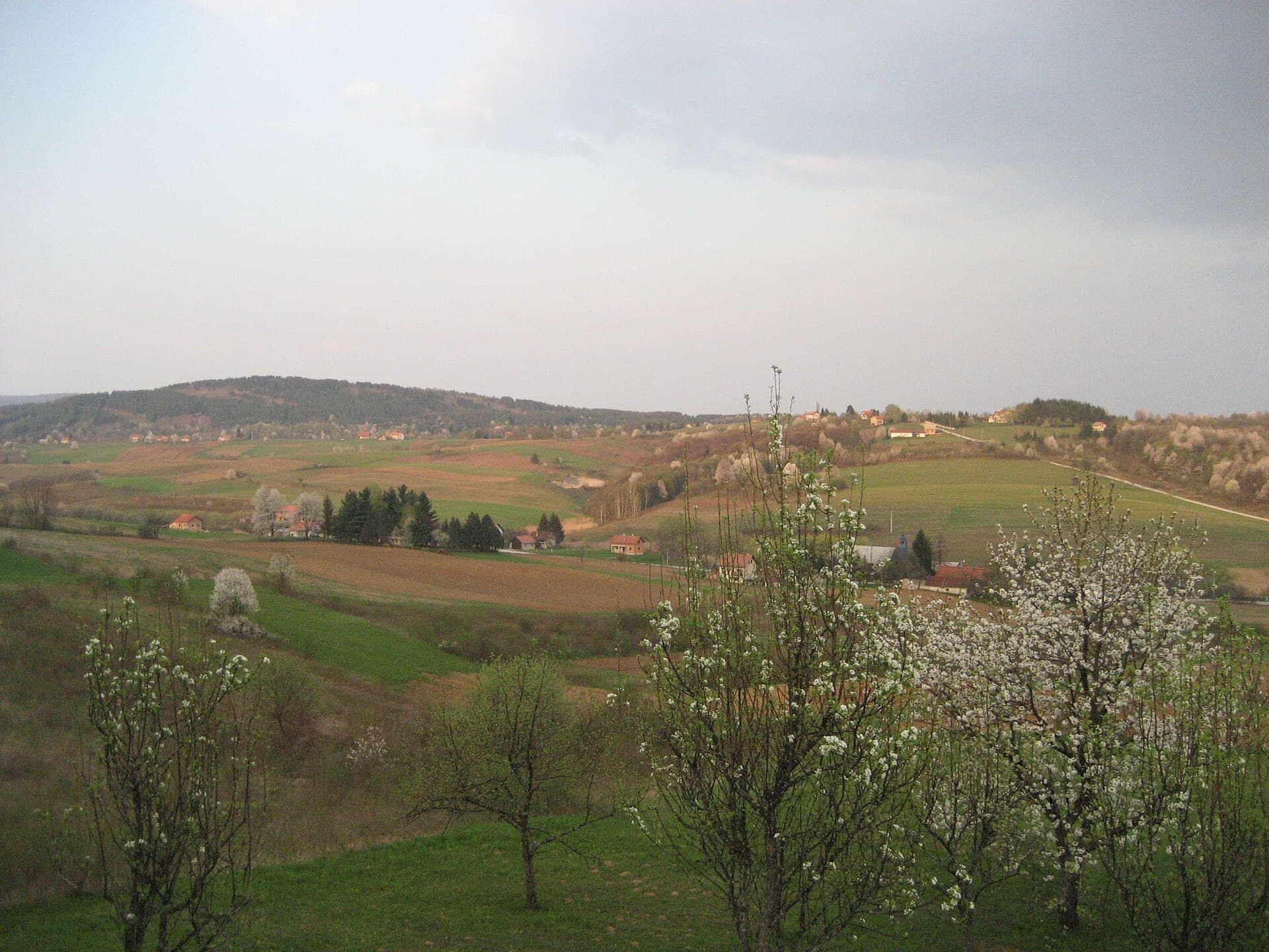
About this place
Rakovica sits on the Kordun route to Plitvice Lakes, yet it offers considerably more than a convenient overnight stop. Its municipal area combines the Korana karst landscape, Barać Caves at Nova Kršlja and the ruined hilltop stronghold of Drežnik, making it possible to build a varied day around underground geology and frontier history. Entry to the Upper Barać Cave is by guided tour only, while the nearby Speleon centre interprets the subterranean heritage of the Rakovica area. The cave remains at 9°C, so an extra layer is useful even during a hot Croatian summer. Rakovica also occupies a distinct place in national history through Eugen Kvaternik’s 1871 uprising; the local primary school still carries his name. Drežnik Grad provides the clearest link with the former defensive landscape above the Korana. Accommodation and dining are spread across Rakovica, Grabovac, Irinovac and Selište Drežničko, making a car especially useful. FlixBus uses a stop at Rakovica 93, and its route to Plitvice Lakes covers about 14 kilometres.
Rakovica lies between Slunj and Plitvice Lakes, where Kordun meets Lika along the D1 state road. Its identity is not concentrated in one compact old town but distributed among small settlements and karst landmarks: Nova Kršlja is associated with Barać Caves, Drežnik Grad with its ruined fortress, and Grabovac with much of the visitor infrastructure. The Korana runs through the municipality, carving the landscape seen from the Drežnik and Selište Drežničko area. Karlovac County’s tourism authority presents Rakovica as a gateway to Plitvice, while also singling out its caves and pits as the foundation of a distinct local speleological tradition.
Stays nearby
 Apartment
Apartmeni Klenovica.eu
Klenovica
64 km from Rakovica
up to 4 guests · 1 bedroom
The host confirms the exact price for your dates and availability.
Things to see
The Upper Barać Cave is visited along an illuminated route with a guide who interprets its formations, archaeology and evidence of cave bears. A short distance away, the contemporary Speleon centre explores the underground heritage and karst of the Rakovica area. Drežnik’s old fortress occupies a rise above the Korana and survives as a reminder of the former military frontier facing the Ottoman Empire. The Karlovac County visitor guide lists both the Drežnik stronghold and Barać Caves among Rakovica’s principal sights. Within Rakovica village itself, the defining historical reference is Eugen Kvaternik’s Rakovica Uprising of 1871.

Beaches
Things to do
Begin at Speleon, whose exhibition explains the karst before you encounter the real underground environment of the Upper Barać Cave. The guided cave visit lasts roughly 45–60 minutes and takes place at a steady 9°C. Afterwards, follow the walking trails through the protected landscape; they remain accessible year-round when conditions are suitable. Continue in the afternoon to Drežnik’s old fortress and explore the surviving defensive structure above the Korana landscape. The day can finish in Grabovac with basa cheese and made-to-order flatbread at Plitvički Dvori, or with an activity at the adventure park in Selište Drežničko overlooking the Korana canyon.
Food and drink
Dining in the municipality is spread along the D1 through Grabovac, Irinovac, Čatrnja and Selište Drežničko rather than concentrated in Rakovica’s centre. Plitvički Dvori in Grabovac specifically promotes basa, local cheeses and flatbread baked to order, making it a useful address for flavours associated with the Lika–Kordun hinterland. Restaurant Degenija operates in Selište Drežničko, Sedra is in Irinovac, and Plitvice Holiday Resort has its restaurant in Grabovac. The county tourism authority also lists Plitvička Vrela, Appetit Plitvice and Plitvički Dvori; contacting the chosen restaurant directly is sensible outside the main visitor season.
Practical information
Practical information
The Plitvice Valleys Tourist Board is based at Rakovica 6, while the municipal information page also lists a tourist information centre in Grabovac. Closed footwear and an extra layer are appropriate for Barać Caves because the Upper Cave remains at approximately 9°C; individuals, families and groups of fewer than 15 do not need to announce their visit in advance. Pets cannot enter the cave, although staff can watch them on a lead near the picnic area. The Barać Caves institution keeps its walking trails available throughout the year but advises visitors not to use them in poor weather.
Getting there and around
Rakovica stands on the D1 between Karlovac, Slunj and Plitvice Lakes, so a car is the easiest way to connect its dispersed attractions. FlixBus identifies its local stop at Rakovica 93 and gives a distance of 14 kilometres to Plitvice Lakes, with a minimum journey of about 14 minutes. For Zagreb, the operator’s 2026 information shows a minimum distance of 123 kilometres and a fastest journey of 1 hour 56 minutes. Local movement still requires planning: Barać Caves are at Nova Kršlja, the fortress is in Drežnik Grad, and many restaurants are in Grabovac or Selište Drežničko.
Frequently asked questions
How long is the Barać Cave tour?
The guided Upper Barać Cave tour lasts about 45–60 minutes, and the temperature remains close to 9°C.
Must Barać Caves be booked in advance?
Individuals, families and groups of fewer than 15 need no advance notice; larger groups should arrange their visit.
Where is Rakovica’s tourist office?
The Plitvice Valleys Tourist Board is at Rakovica 6, with a tourist information centre also listed in Grabovac.
Are dogs allowed inside Barać Cave?
Pets cannot enter the cave, but staff can watch them on a lead near the picnic area during the tour.


Related guides

Senj
Senj occupies a narrow strip between the sea and the Velebit foothills, so its streets climb quickly from the harbour towards Nehaj Fortress. The Uskoks, the fierce bura wind, seafaring and…
Read the guide

Help improve this page
Spot something missing or wrong? Suggest a correction, add your photo or report a problem. Editors review every suggestion before it is published.
Photo credits
- Rakovica, Saborsko, Caves of Barać — Modzzak · CC BY-SA 3.0 · Wikimedia Commons
- Slunj, Cetin Castle — Neoneo13 · Public domain · Wikimedia Commons
- Smoljanac — ANDREJ NEUHERZ · CC BY-SA 3.0 · Wikimedia Commons