Hrvace
About this place
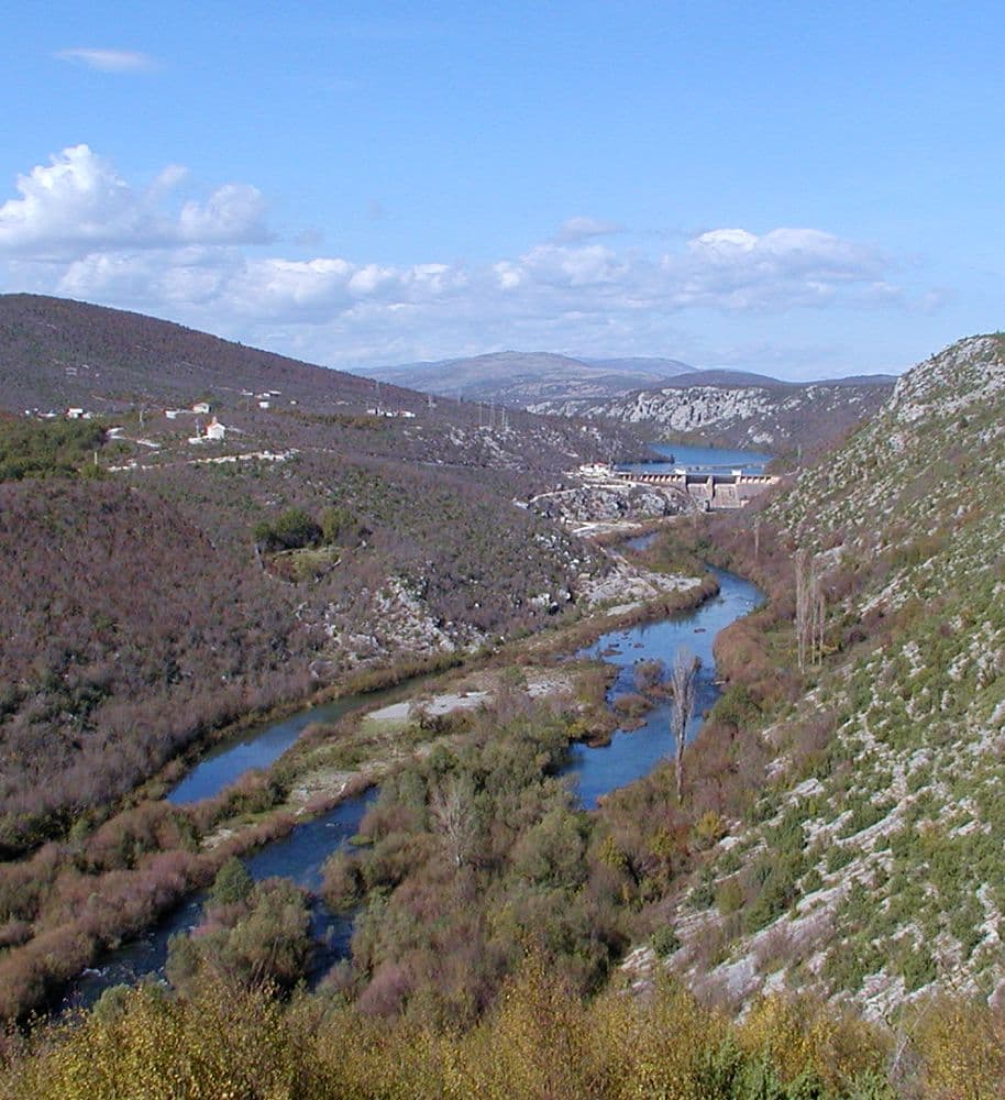
Hrvace is the municipal centre of the Cetina region, with its northeastern landscape opening towards Lake Peruća, the Cetina’s reservoir. The Peruća dam was built between Satrić and Gornji Bitelić in 1958, and the hydroelectric plant entered service in 1960, shaping the wider Hrvace area ever since. The reservoir runs for about 20 kilometres, covers 13 square kilometres and reaches 64 metres at its deepest point. At roughly 360 metres above sea level, it offers a distinctly inland version of a Dalmatian summer. Dabar, a village within the Municipality of Hrvace, sits on its shore, where the Točilo spring flows into the lake and the Tamnica cave is found. Lake Peruća is used for rowing, recreational fishing, camping and swimming. Hrvace is therefore a base for discovering the upper Cetina and Peruća’s lakeside scenery rather than a seaside resort.
Hrvace is not an Adriatic resort but the largest settlement and administrative centre of a municipality on the northern edge of the Sinj field. The D1 crosses the village, yet its character is more clearly expressed by its springs, two small lakes and local institutions bearing regional names, including the Peruća folklore ensemble, Klapa Hrvace and NK Hrvace. At nearby Rumin, farmland gives way sharply to karst: the protected landscape embraces the Mali and Veliki Rumin streams, cliffs, grassland and an old watermill. Its waters shelter endemic fish of the Cetina basin, including the Cetina minnow and Dalmatian spined loach. Recreational fishing is prohibited within the protected Rumin landscape, making it a place for walking and nature observation rather than an angling excursion.
Stays nearby
 Apartment
Apartmeni Klenovica.eu
Klenovica
Klenovica, 205 km from Hrvace
up to 4 guests · 1 bedroom
The host confirms the exact price for your dates and availability.
Beaches
Hrvace has no seafront beach; swimming trips lead instead to the shores of Lake Peruća on the Cetina. Created after the Peruća dam was built in 1958, the reservoir covers 13 square kilometres between the Sinj and Vrlika areas. The Croatian Encyclopedia specifically lists swimming, rowing, camping and fishing among its recreational uses. At Dabar, a village in the Municipality of Hrvace on the lake shore, the Točilo spring flows directly into the reservoir. As this is a natural lakeside setting, bring your own essentials and choose your water access point with care.
Things to do
Begin in Hrvace beside the Miloševo and Stipančevo lakes, then continue to the hamlet of Panj at Rumin. A stone bridge built between 1895 and 1905 spans the stream on seven arches before the Rumin joins the Cetina. To reach the Greda spring, walk for roughly fifteen minutes from Bajagić through the canyon; leave fishing equipment behind because angling is prohibited inside the protected landscape. Reserve the second half of the day for Lake Peruća, the Cetina reservoir used for rowing, swimming and camping, with fishing governed by the rules applying outside Rumin. Back in Hrvace, the route can end near NK Hrvace’s football ground or at a performance by the Peruća folklore ensemble when one is scheduled.
Practical information
Getting there and around
Hrvace stands directly on the D1 state road along the Sinj–Knin corridor, making a car the simplest way to arrive and reach the municipality’s scattered sites. For Rumin, leave the main route towards the hamlets of Panj and Bajagić; the final approach to Greda spring is a walk of about fifteen minutes. Lake Peruća extends north of Sinj, with the Croatian Encyclopaedia placing it near Donji Bitelić, 16 kilometres from the town. Because Hrvace, Rumin and the lake-access points are separated from one another, private transport or a pre-arranged transfer is more practical than attempting the circuit solely on foot. Take particular care when crossing the D1, which is the settlement’s main traffic artery rather than a pedestrian promenade.
Frequently asked questions
Is fishing allowed at Rumin?
No. Recreational fishing is prohibited within the protected Rumin landscape.
How long is the walk to Greda spring?
Allow roughly fifteen minutes to walk from Bajagić to Greda spring.
Does Hrvace have a sea beach?
No. Hrvace is inland, with local swimming associated with nearby Lake Peruća on the Cetina.

Related guides

Split
In Split, the transition from ancient monument to ordinary street is almost imperceptible: entering the southern part of Diocletian’s Palace from the Riva leads towards the Peristyle, then…
Read the guide

Help improve this page
Spot something missing or wrong? Suggest a correction, add your photo or report a problem. Editors review every suggestion before it is published.
Photo credits
- Hrvace — Zoran Knez at English Wikipedia · Public domain · Wikimedia Commons
- Rumin — Marko Split · Public domain · Wikimedia Commons
- Apartmeni Klenovica.eu — Apartmani Klenovica.eu · courtesy of the property owner
- Split — dronepicr · CC BY 2.0 · Wikimedia Commons
- Baška Voda — Mario Žamić · CC BY-SA 3.0 · Wikimedia Commons
- Tučepi