
Barilović
About this place
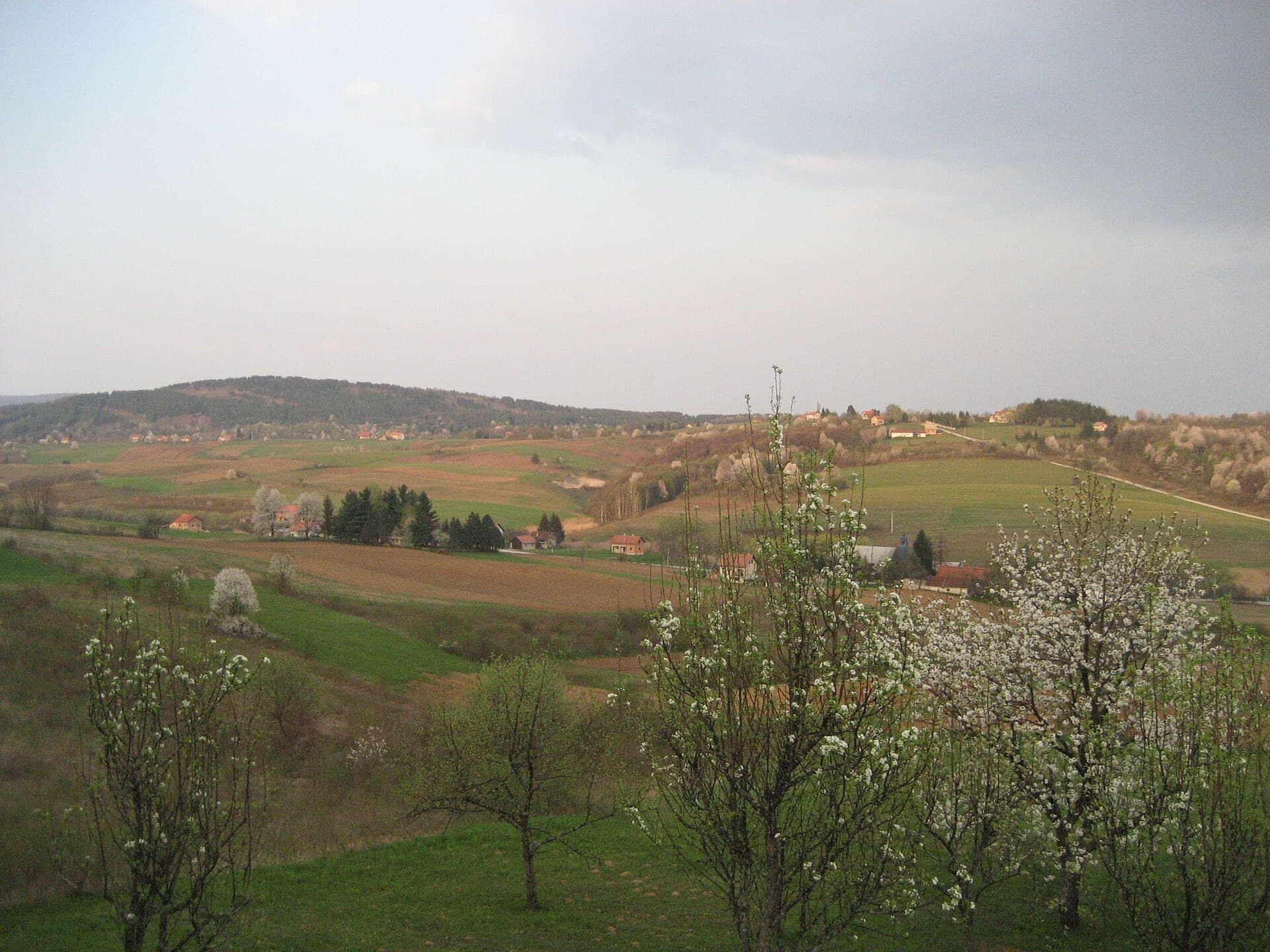
Barilović is a small settlement on the Korana, about fifteen kilometres south-west of Karlovac, dominated by the ruins of the medieval castle bearing its name. The noble Barilović family built the stronghold on a steep rock above the river’s left bank and first appears in surviving records in the mid-15th century. The difficult rocky site shaped the feudal complex’s irregular plan and its defensive function on the former frontier with the Ottoman Empire. The Croatian Conservation Institute has conducted archaeological, geotechnical, geodetic and photogrammetric investigations here, as well as stabilising sections of the defensive walls and the eastern tower. The blue-green Korana flows beneath the ruins and provides the main natural focus for Barilović and its summer river bathing places. Vražić Cave lies on the opposite, right bank; its entrance passages extend roughly 150 metres towards a pond, while one channel reaches a depth of 20 metres. A county bus route connects Barilović with Duga Resa via Belaj and Gornji Velemerić, then continues through Carevo Selo, Barilovački Leskovac and Siča to Lučica. A car or bicycle remains more practical than relying entirely on limited local departures when combining the castle, the Korana and the area’s scattered sites.
Barilović is shaped by the space between its castle rock and the Korana rather than by a conventional urban centre. The village administers a municipality extending towards the Mrežnica, yet it is the fortress above the Korana’s left bank that gives the settlement its unmistakable silhouette. The noble Barilović family appears in records from the mid-15th century, and the form of the rock dictated the scale and irregular plan of their feudal stronghold. River bathing places, caves and archaeological traces define the surrounding landscape; the municipality specifically highlights Vražić Cave, Mramorna Cave near Siča, Bubijeva Pit and Martinščak hill.
Stays nearby
 Apartment
Apartmeni Klenovica.eu
Klenovica
63 km from Barilović
up to 4 guests · 1 bedroom
The host confirms the exact price for your dates and availability.
Things to see
Stari grad Barilović
Landmark · Barilović
Things to do
Begin at Barilović Castle, whose surviving walls cling to a steep rock above the Korana’s left bank. View the site only from established, safe approaches: the Croatian Conservation Institute describes its position as difficult to access and the supporting rock as degraded. After seeing the fortress, descend towards the Korana and look across the river towards Vražić Cave, whose entrance passages extend for about 150 metres. A wider driving circuit can include Siča and Mramorna Cave, while the ruins of the medieval Skrad fortress stand upstream on Skradska Gora.
Practical information
Getting there and around
Autotransport Karlovac operates the Duga Resa–Barilović–Lučica county route. According to the published stop sequence, buses from Duga Resa pass through Varoš Kapelica, Vinica, Belaj, Gornji Velemerić and Mejaško Selo before reaching Barilović, then continue via Carevo Selo, Barilovački Leskovac, Koranski Križ, Šćulac and Siča to Lučica. Barilović lies roughly fifteen kilometres by road south-west of Karlovac. Because the castle, river approaches and cave sites are dispersed, a car makes exploration considerably easier, while the bus is most useful for a pre-planned arrival from Duga Resa.
Frequently asked questions
When was Barilović Castle built?
Archaeological research dates the fortress to the 15th century, and the Barilović family first appears in surviving records in the middle of that century.
Where is Vražić Cave?
The cave is on the Korana’s right bank opposite Barilović Castle, and its entrance passages extend for about 150 metres.
Is there a bus from Duga Resa to Barilović?
Yes. Autotransport Karlovac publishes a Duga Resa–Barilović–Lučica county route via Belaj and Gornji Velemerić.
Nearby
Leskovac Barilovićki
Village · Lika – Karlovac
Koranski Brijeg
Village · Lika – Karlovac
Related guides

Senj
Senj occupies a narrow strip between the sea and the Velebit foothills, so its streets climb quickly from the harbour towards Nehaj Fortress. The Uskoks, the fierce bura wind, seafaring and…
Read the guide
Help improve this page
Spot something missing or wrong? Suggest a correction, add your photo or report a problem. Editors review every suggestion before it is published.
Photo credits
- Barilović — Eranyo · CC BY 3.0 · Wikimedia Commons
- Apartmeni Klenovica.eu — Apartmani Klenovica.eu · courtesy of the property owner
- Senj — Palauenc05 · CC BY-SA 4.0 · Wikimedia Commons
- Rakovica — Modzzak · CC BY-SA 3.0 · Wikimedia Commons
- Karlobag — Orlovic · Public domain · Wikimedia Commons
- Slunj

