Kučiće
About this place
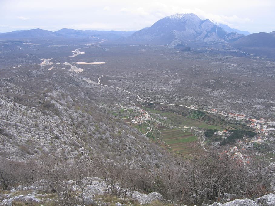
Kučiće is a village in the Omiš hinterland, occupying rising ground above the lower Cetina and beneath the slopes of Omiška Dinara. Although administratively part of the City of Omiš, it is not a coastal resort: Kučiće lies about 12 kilometres from Omiš and the Cetina estuary, at approximately 200 metres above sea level. Its written record reaches back to 1315, when Prince Juraj II’s charter mentioned the settlement as Cuchani. The principal local monument is the cemetery church of St Luke. Archaeological work in 2016 uncovered the foundations of a small Gothic church with a rectangular apse, dated between the mid-fourteenth and mid-fifteenth centuries. St Luke’s present form derives from the mid-eighteenth century and an enlargement during the latter half of the nineteenth century. Hamlets, karst fields, the Cetina and the steep frame of Omiška Dinara define the Kučiće landscape, making the village more relevant for exploring inland Omiš than for a beach holiday. The Omiš–Kučiće–Zadvarje road, completed in 1899, still explains its position between coast and hinterland.
Stays nearby
 Apartment
Apartmeni Klenovica.eu
Klenovica
Klenovica, 242 km from Kučiće
up to 4 guests · 1 bedroom
The host confirms the exact price for your dates and availability.
Things to do
The most rewarding visit in Kučiće centres on St Luke’s Church and its surrounding cemetery. Excavations undertaken in 2016 uncovered the foundations of a small single-nave Gothic church with a shallow rectangular apse beneath the present building, dating from the mid-fourteenth to the mid-fifteenth century. The standing church took shape in the mid-eighteenth century and was enlarged during the latter half of the nineteenth. After St Luke’s, follow part of the old road towards Zadvarje and stop at the chapel beside the school, erected in 1928 to fulfil a vow made by Anton Topić in 1916.
Practical information
Getting there and around
Kučiće stands on the Omiš–Zadvarje road completed in 1899, about 12 kilometres from each town. The City of Omiš lists the Ravnički Most–Omiš–Split bus corridor among its transport links, while the local approach to Kučiće continues inland through Cetina-side settlements. Travellers arriving from Split or Makarska first reach the Omiš transport hub and then turn into the hinterland. Because Kučiće consists of scattered hamlets, with St Luke’s Church and approaches to the Cetina lying beyond a single central point, a car is more practical for local movement than reliance on one bus stop.
Frequently asked questions
Is Kučiće on the coast?
Kučiće lies in the Omiš hinterland, about 12 kilometres from Omiš and approximately 200 metres above sea level.
When was Kučiće first recorded?
Kučiće was first recorded as Cuchani in a 1315 charter issued by Prince Juraj II Šubić.
When do Kučiće first appear in written sources?
A 1315 charter of Prince Juraj II Šubić records the settlement’s inhabitants as Cuchani.
Which archaeological sites have been investigated in Kučiće?
Investigated sites include the medieval Greblje cemetery, with 23 graves dated from the 12th to 14th centuries, and the Roman-era site of Pločje.
Nearby
Seoca, Omiš
Village · Dalmatia – Split

Related guides

Split
In Split, the transition from ancient monument to ordinary street is almost imperceptible: entering the southern part of Diocletian’s Palace from the Riva leads towards the Peristyle, then…
Read the guide

Help improve this page
Spot something missing or wrong? Suggest a correction, add your photo or report a problem. Editors review every suggestion before it is published.
Photo credits
- Seoca, Omiš — Pseudoznanstvenik · CC BY-SA 3.0 · Wikimedia Commons
- Mimice — d.graso · CC BY 3.0 · Wikimedia Commons
- Lokva Rogoznica, Baška Voda — Mario Žamić · CC BY-SA 3.0 · Wikimedia Commons
- Marušići, Omiš — Mario Žamić · CC BY-SA 3.0 · Wikimedia Commons
- Apartmeni Klenovica.eu — Apartmani Klenovica.eu